Monday, September 19, 2011

Show Me

Another weekend, another 14er. I climbed Missouri Mountain on Sunday. At 14,073 feet, Missouri Mountain is shortest of the 14ers I did this season, but it may be my favorite of the five. I used the Missouri Gulch Trailhead which is the same trailhead I used the previous weekend for my hike up Mt. Belford and Mt. Oxford. The hike is 10 miles round trip. I started at daybreak. It was a bit on the cold side. The mountains had a touch of snow on them at the higher elevations. There was dramatic drop in the number of people hiking this weekend. I saw only four other people climbing Missouri Mountain. I had the summit to myself. The wind was a bit brutal up top, but I found a spot out of the wind on southwest side where I was able sit and enjoy the view. On the way down, I warmed up enough to strip down to shorts and a short sleeve shirt. This is probably it for my tour of 14ers in Sawatch Range this season. I'll be busy with the Rapids back in town the next couple of weekends. It won’t be long for it to be too cold for my tastes at the higher elevations. Anyway, enjoy the photos.
The climb up this ridge is where the trail gets a little tough.
Looking back on the easy part of the trail.
Looking back from the top of the ridge. Mt. Belford (Left) Mt. Harvard (right)
Huron Peak
The trail on the ridge
The top of Missouri Mountain is in sight.
View from the top. The Three Apostles are in the clouds.
Huron Peak
Mt. Princeton, Mt. Yale, Mt. Antero, Mt. Shavano, & Tabeguache Peak
Harvard and Columbia on the left.
The ridge of Missouri Mtn. La Plata Peak (center) Mt. Elbert (right)
Missouri Gulch. The shoulder of Mt. Belford is on the right.
Mt. Belford is on the left. Mt. Oxford is peaking out in the middle.
Me
Mt. Belford from Missouri Gulch.

Sunday, September 11, 2011

The Rising

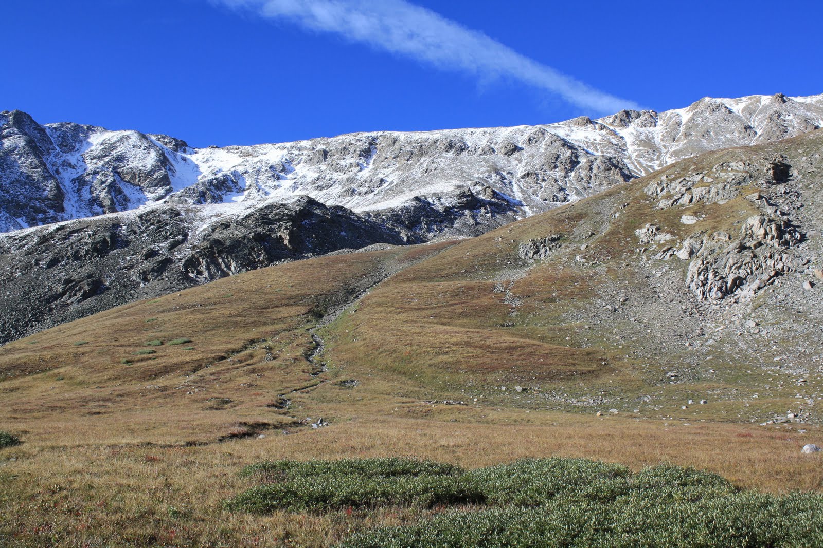
Today, I climbed my 10th and 11th 14er. I did Mt. Belford (14,205 ft.) & Mt. Oxford (14,160 ft.) The mountains are located in the Collegiate Peaks Wilderness northwest of Buena Vista. I took the standard route from the Missouri Gulch trailhead (9,640 ft.) Mt. Belford was the first and last of the 14ers I climbed on the day. It was 3 and half mile hike to the top of Mt. Belford from the trailhead. It was quite cold on top of Mt. Belford. I didn’t stay too long due to the wind and because I needed to keep moving so that I could climb Mt. Oxford.
Mt. Oxford from the top of Mt Belford.
Top of Missouri Mtn. on the right. Huron Peak is right center behind the ridge.
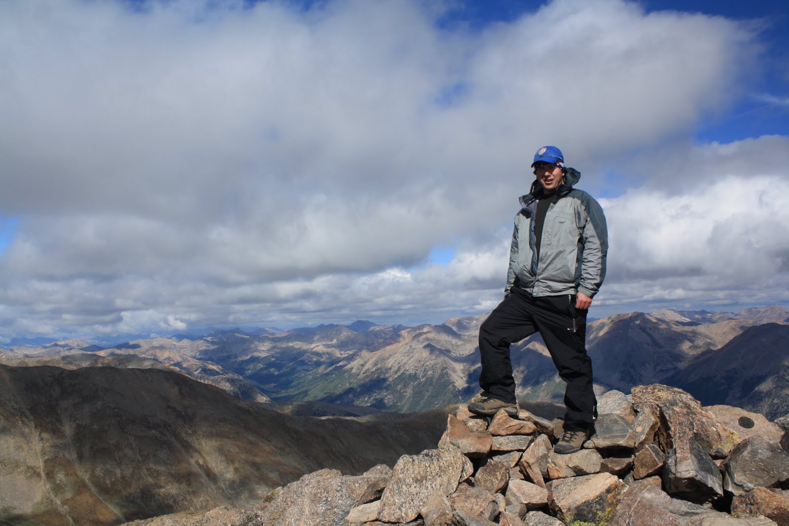
Me on Mt. Belford
From the top of Mt. Belford, I hiked down to a saddle of about 13,500 feet. I then started up Mt. Oxford. Trail distance between Mt. Belford and Mt. Oxford is about 2 miles. The climb up Mt. Oxford from the saddle was relatively easy. By the time I got to the top, the Sun was partially out, and the wind did not seem as bad.

Me on top of Mt. Oxford

Looking back on Mt. Belford.
Mt. Harvard. To the right of Mt. Harvard is Mt. Yale with its top in the clouds.
Look,there is a pika on that rock.
To get back to my car I had to backtrack back over Mt. Belford. The climb up Mt. Belford from the saddle is quite steep. I would say it was toughest part of the hike. I made it, and I was rewarded with some nicer temperatures on top Mt. Belford. I could also see a little bit more. There were surprisingly a lot of clouds in the area this morning. The clouds never threaten, but I kept an eye on them. I made it back to my car around 2 pm. It was a tough day, but obviously it was worth it.

Me on Mt. Belford again
The way down
Mt Oxford on the left and the summit of Mt. Belford on the right.
LaPlata Peak on the left. Mt. Elbert is right center.
An alpine flower.

Tuesday, September 06, 2011

Number 9, Number 9, Number 9...

On Monday, I reached the summit of Mt. Antero (14,276 ft.) It is the second 14er I’ve hiked this year and my ninth overall. There is a 4WD road that goes up to 13,700 feet. The standard route is the 4WD road. I didn’t want to hike up the 4WD road so I took a different route that avoided the road except for a small section near the end. I started at Browns Creek Trailhead at an elevation of 8,920 feet. I hiked up the Little Browns Creek Trail. Round trip for this route is listed as 14 miles. I wanted to be on top before the 4WD traffic got there, so I started the hike on Sunday. I hiked up about half way and camped. I was up early Monday morning, and I made it to the top of Mt Antero by 8:45 AM. I had the summit to myself the whole time I was up there. Some 4WD traffic had reached the end of the road while I was on the summit, but nobody was willing to take the short hike. They were either too attached to their veeHICles, or they were looking for gems. Apparently, the mountain is big for gem collectors. On the way down, I saw the three people hiking up the road (the standard route). I think they were the only ones going to the summit. Once I was off the road, I didn’t see a soul until I was a half mile away from my car.
View of Mt. Antero from the end of the 4WD road.
Mt. Princeton on the right. Yale, Harvard, & Columbia are to the left of Princeton
Mt. Shavano (left) & Tabeguache Peak(right)
Looking southwest from the summit.
Me on the summit
Little Browns Creek Trail. Pikes Peak is on the horizon.
Looking back on the trail. The summit is not visible