
Thursday, December 18, 2014
Sunday, November 30, 2014
Colorado Wasted
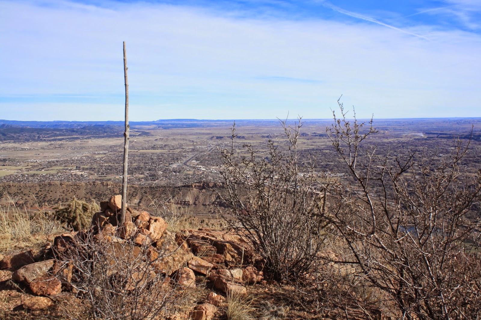
It has been too long since I have done a hike. I couldn’t skip hiking on Thanksgiving. It is my tradition. The day was beautiful. It was in the upper 60’s. A little windy though. As for myself, I am out shape since I haven’t been hiking since July. So naturally, I did a hike where there are no trails which made it tougher. There are talks about putting a trail system around Fremont Peak near Royal Gorge. I went out looking for possible routes. The route I chose on Thursday had too many loose rocks. I decided against trying to complete what I had in mind. I went out again on Friday but chose a different route. This route was better. I also felt better after having loosened up my hiking muscles the day before. I climbed to the top of Nonans Peak. The peak has an elevation of 6900 feet. Not very tall for Colorado standards, but my hike started from the Arkansas River. So I had about a 1500 foot elevation gain which good enough to get the heart pumping again. The hike was grand. Lots of cliffs and great views. Here are some pictures from the hike.
 |
| View of Cliffs |
 |
| Tree Antler |
 |
| Arkansas River |
 |
| Royal Gorge Bridge |
 |
| Nonans Peak (on the left beyond the cliffs) |
 |
| Arkansas River |
 |
| Sangre de Cristo Mountains on the horizon |
 |
| Fremont Peak on the right |
 |
| Top of Nonans Peak with Cañon City below |
 |
| Pikes Peak on the right |
 |
| Royal Gorge |
Thursday, July 31, 2014
In The Rapids
The grand finale to my vacation was a rafting trip through Royal Gorge. Jim, Stacy, Carter, and I did the trip on July 6th. The water levels were still higher than normal, and it made for a real fun trip through the Gorge. Stacy bought the pictures of our trip that the rafting company sold. Here are some of the highlights.


 |
| Carter is up front for this one and the following pictures |
Tuesday, July 22, 2014
The Eye
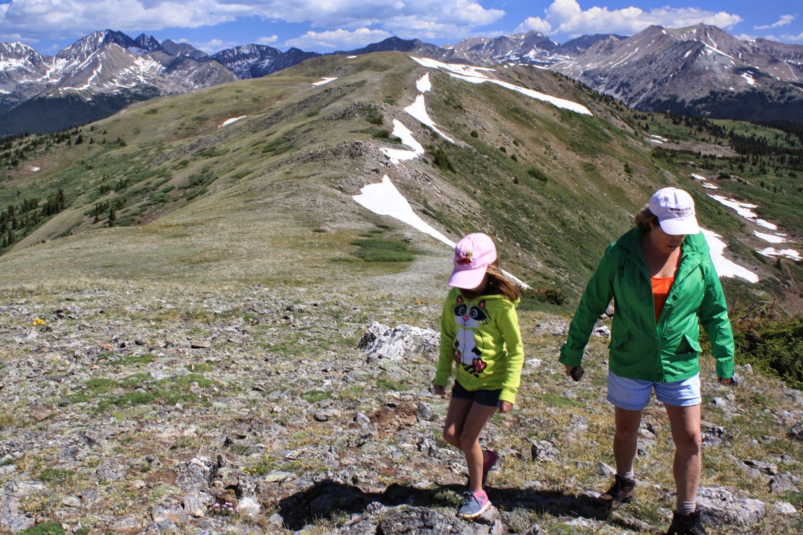
On July 4th, my brother and I climbed Mt Ouray. At an elevation of 13,979 feet, Mt. Ouray is 29 feet short of being a popular mountain. It is one of the Centennial Peaks of Colorado. Mt. Ouray is located at the southern end of the Sawatch Range near Salida. The trailhead is at Marshall Pass (10,846 ft) although there is not much of a trail up it. You basically just follow the ridge up. There was a bit of rock scrambling and the wind was blowing really hard on the hike up. I think the hardest part was just being out of shape. I haven’t done much hiking this year. We didn’t see anybody on the hike up. We had the summit to ourselves; however, we did see five going up on our way down. I'm guessing it was a busy day for the mountain since it was the 4th of July. I don’t think this mountain gets hike a lot. Here are the pictures.
 |
| View of Antora Peak after reaching the ridgeline |
 |
| The route up Mt. Ouray |
 |
| Jim on top of Mt. Ouray |
 |
| Jim on top of Mt Ouray. Antora Peak on the left |
 |
| Brothers |
 |
| Nap time. Salida in the valley below |
 |
| Looking towards Monarch Pass |
 |
| Me |
 |
| The Eye |
 |
| Looking back at the route up Mt Ouray |
Tuesday, July 15, 2014
Continuing
On July 3rd, a group of us made the drive from Salida to Cottonwood Pass for a little sight-seeing. Most people go for a hike along the Continental Divide on the south side because the parking lot is on that side of the road and the mountains are a little bigger. I don’t remember who suggested it, but the decision was made to take a walk on the north side of the road. It was a great choice. We didn’t see anybody on our short hike, plus we got away from the road rather quickly. Here are the pictures from Cottonwood Pass.
 |
| Carter, Jim, Stacy, & Cara along the Continental Divide |
 |
| Cottonwood Pass |
 |
| Jim |
 |
| The Three Apostles & Huron Peak on the left. Missouri Mountain & Mt. Belford are visible on the right. |
 |
| Cara & Stacy |
 |
| Cara putting a rock on top of the small unnamed peak |
 |
| Looking down at the lake at Cottonwood Pass |
 |
| Cara, Jim, & Carter |
 |
| Time to throw snowballs at Carter |
 |
| Sunflowers & The Three Apostles plus Huron Peak |
 |
| Stacy & Cara (Mt. Yale on the left) |
Wednesday, July 09, 2014
Dust In The Wind
On July 1st, we traveled from Pagosa Springs to The Great Sand Dunes National Park. We made a lunch stop at Three Barrel Brewing in Del Norte. The beer and food was good. It is worth a stop. We stayed at the Great Sand Dune Lodge right outside the National Park. After watching the US game, we went into the Park. Medano Creek was dry at the day use area in the Park. The wind was blowing harder than I had experienced on previous visits. The wind has been known to blow there. Anyway, Carter and I walked the farthest out on the dunes, which wasn’t that far. This is the only photo I took from that hike.
That evening at the lodge, a highly entertaining lightning show appeared over the dunes. I didn’t capture any lightning, but I got some nice pictures around sunset.
The next day we went back out on the Dunes. It was windy, but it was nowhere near as bad as it was the day before. Medano Creek was flowing at the day use area. Jim and I made it to the top of High Dune.
After hiking the Dunes, we hiked to Zapata Falls. After lunch, we drove to Salida, the next stop of the tour.
-MM
 |
| Carter |
 |
| View from the Great Sand Dunes Lodge |
 |
| Stacy and Cara on their porch at the Lodge |
 |
| Sunset |
 |
| The Dunes |
 |
| Sunset - San Juan Mountains in the distance |
 |
| Another sunset photo |
 |
| My parents making their way onto the Dunes |
 |
| Jim |
 |
| Jim on top of High Dune |
 |
| The Dunes from the top of High Dune |
-MM
Subscribe to:
Posts (Atom)
