Monday, August 29, 2016

Rocky Mountain High

On Saturday, August 27, I did something that I haven’t done in a few years. I climbed a 14er. I summited Castle Peak which has an elevation of 14,279 feet. I got on the trail early for this one. I started a little after 3:30 a.m. I had to park at the lower trailhead due to my car not being able to handle the road. So I had a starting elevation of 9,800 feet. The first part of the hike was easy because all I was doing was following a road in the dark. I made good time until I got to Montezuma Basin (12,800 ft.) The road ended there and the trail got steep. There was also the added addition of fresh snow at this elevation. It was a bit cold. I actually had to zip up my jacket while going uphill. I don’t do that often when climbing.
Dawn from Montezuma Basin
Fresh snow and start of steep climb.
Castle Peak
The final ascent of Castle Peak followed the northeast ridge to the top. The route wasn’t well marked in places. I was following tracks in the snow of a person that didn’t choose the best route. I had to back track a little to get around a hairy spot. I made it to the top after 9:00 a.m. The view at the top was incredible.
Conundrum Peak from the northeast ridge of Castle Peak
Looking back on the trail that gains the northeast ridge
The final climb to the summit of Castle Peak
Conundrum Peak before the final ascent of Castle Peak
View from the top of Castle Peak
View to the south from Castle Peak
Looking back on the northeast ridge from the top of Castle
A picture of me from the top
Me on the top of Castle Peak
Maroon Bells, Snowmass, etc.
There is an option to hike over to Conundrum Peak (14,060 ft), but I decided against it. Conundrum Peak is not an official 14er. It lacks the 300 foot prominence for it to be a separate peak. Conundrum Peak is considered a sub-peak of Castle Peak. I would have liked to have done it, but I was tired and worried about the route down from Conundrum which is steep through loose rocks. So I returned the way I came which was tough enough. I made it down without issue. I even got a ride back to my car for the last couple of miles. So a 13.5 mile hike was shorten to about 11.5 miles.
Conundrum Peak from the top of Castle Peak
From Montezuma Basin: the fresh snow has melted.
The road is the trail here.

Thursday, August 25, 2016

Ebony and Ivory

For my final hike in this Colorado Trail series, I did a slack pack that took place on Thursday, August 4, 2016. I did the southern tip of the Collegiate Peaks Loop. I got dropped off at Monarch Pass. The Pass was in the clouds. I headed south on the trail and was above the clouds in a matter of a few minutes. It was wonderful sight in the early morning light.
Trees and clouds
Above the clouds
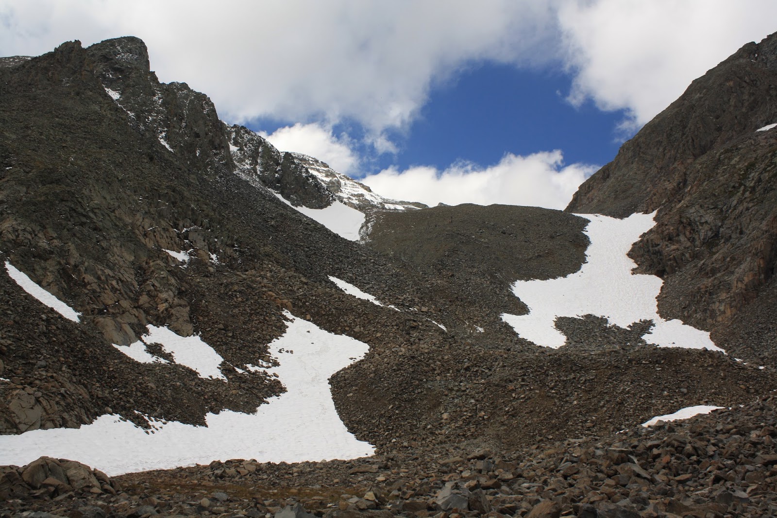
Mountains and Clouds
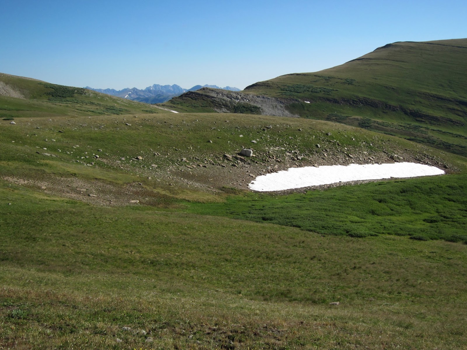
Being above the clouds did not last. The clouds eventually rose, and I was hiking in a light misty rain. It wasn’t bad; I wore my rain jacket like a cape to keep my day pack dry. The first 5 miles of the hike followed close to the ridge line on the Continental Divide. I was right on the edge of tree line. After 5 miles, the south end of the Collegiate West and the south end of the Collegiate East meet.
Looking back at Monarch Pass
Looking south on the trail. Mt. Ouray peaking out (left/center)
Zoom view of Mt. Ouray
Where Collegiate East and West collide
At this point, I went north on the Collegiate East portion for 8.5 miles of downhill walking along the South Fooses Creek drainage. The first half mile was a steep as the trail dropped down off of the Divide. The grade got a lot easier after the first half mile. Of course, I was going downhill. Everybody that I saw was going uphill. They might have a different opinion. Near the top of the drainage, I went through some of the most beautiful meadows of wildflowers that I have seen. There were so many colors. Here is my attempt at trying to capture some of that beauty.
Wildflowers
And Wildflowers
More wildflowers
Close-up of Wildflowers
The trail through wildflowers
Another close up of wildflowers
One more wildflower
As for the title of this post; when I hike, I have a tendency to get songs stuck in my head. A lot of times they are annoying songs. Throughout this series of hikes on the Colorado Trail, I had the song “Ebony and Ivory” repeating in my head. I don’t know the lyrics or music for the whole song, so it was the same parts over and over again. So in honor of that, I named the final post in this series “Ebony and Ivory”.
A map of what I have done of the Colorado Trail so far.

Monday, August 22, 2016

The Other Side Of The Mountain

On August 2nd, I continued my hike on the Colorado Trail. I did an overnight hike. I started at Clear Creek Road which is where I had finished my hike from the previous week in the “Hope” post. I headed south on the trail and was greeted with a long uphill hike to start the day off. I went from 8,937 feet to 11,653 feet in the first 4.8 miles. It wasn’t steep; it was just all up. This portion of the Colorado Trail doesn’t cross any major passes or peaks. It does cross several ridges that lead to 14ers. The 4.8 mile mark was the first ridge of the day that I crossed where the ridge did that. This ridge led to Mt. Oxford. I quickly descended this ridge only to climb another ridge. This ridge led to Mt. Harvard.
Cliffs on the ridge that I had climbed in the morning.  (Trail doesn't go by cliffs)
Ridge that leads to Mt. Harvard
Mt. Oxford
At the 9 mile mark on the day, I reached my highest elevation of the day at 11,845 feet. The rest of the day had more downhill than uphill. However, I was still crossing ridges as I hike around Mt. Columbia. After 15.7 miles, I called it a day. It was still early, but I didn’t feel like over doing it.
Another ridge that leads to Mt. Harvard
Buffalo Peaks
Fireweed
Buena Vista
One of the Harvard Lakes
The next day started out easy. I was able to make the first 3 miles in an hour. I dropped down to North Cottonwood Creek at an elevation of 9,430 feet. From there, everything changed. I had a steep uphill climb to gain a saddle on a ridge that leads to Mt. Yale. My hiking pace slowed down big time. The saddle on the ridge was at an elevation of 11,889 feet. An alternate route for climbing Mt. Yale starts at the saddle. I did the standard route on the other side of Mt. Yale several years ago. It is a beautiful mountain. As for this hike, it was all downhill from there. I met my dad at the parking lot at Avalanche Trailhead a couple of minutes early.
Mt. Princeton on the left.  A shoulder of Mt. Yale on the right.
Buena Vista on the left.  Salida on the right/center.
Looking towards at the climb to the ridge that leads to Mt. Yale
Smoke from the Hayden Pass Fire
A meadow and Mt. Yale
Mt. Yale from a saddle at treeline on the east ridge of Mt. Yale
Rainbow Lake

Wednesday, August 10, 2016

Kokomo

I had to take a few days off after the last hike. The days off were planned. We had to take my mom to the airport in Denver. She was off to Vancouver in order to go on a cruise to Alaska. So it is now me hiking with just my dad hanging out as my support. I didn’t plan to start hiking again until the weekend was ending. This was good because my blisters were able to heal during the break.

On Sunday, July 31st I started hiking again. I would do an overnighter from Copper Mountain to Camp Hale. This was a makeup hike from a section I skipped last year. It was after 3 PM on Sunday before I started the hike. My plan was only to hike 6 or 7 miles that day. The plan was to get close to tree line in order to hit the above tree line stuff first thing in the morning. Due to rain, I ended up with a later start than planned but it still fit within parameters I needed to get to the spot I had picked out in the databook. It was raining when we arrived at Copper Mountain. It is hard to start in the rain. Fortunately, I was able to wait it out. I got to my campsite and got my tent set up just before another rainstorm. I had a good campsite. There were some trees next to it that blocked the rain. So I was able to cook dinner in a dry spot.
Copper Mountain - Traffic going to Denver
Trail through meadow
The next day, the skies were bright blue. The day started with about a 1.5 mile hike to some meadows on the edge of tree line. The next 6 miles of hiking were absolutely gorgeous. I hiked through two high passes, Searle Pass at 12,043 feet and Kokomo Pass at 12,023 feet. The high point on the trail was Elk Ridge at 12,282 feet. The hiking was pretty easy since there weren’t any steep climbs. I had all of this to myself. I didn’t see a soul until I got to Camp Hale unless you count the marmots. I saw a couple of pikas, but this alpine area was dominated by marmots.
Colorado Trail marker
Trail going to Searle Pass
Flowers and views
Janet's Cabin at tree line. The trail up is in the valley below.
Me at Searle Pass.  The trail I take is behind me and is all above tree line.
Northeast view from Searle Pass
View to the southeast from Searle Pass
Looking back at Searle Pass
Marmot
Looking toward the mining at Fremont Pass from Elk Ridge
Looking back at Searle Pass from Elk Ridge
Mt. Massive
Kokomo Pass
Trail leaving Kokomo Pass
Mount of the Holy Cross
Approaching Tree Line
I made it down to Camp Hale without issue. My dad was already waiting as always. We went down to Leadville and had lunch. We then drove to Buena Vista where we stayed. That evening, I prepared for my next hike that would take place the next day.
Coming into Camp Hale
Cataract Falls