Thursday, August 31, 2017

Down

This is the final post for a four day backpacking trip on the Colorado Trail from Molas Pass to Durango. The day was Wednesday, August 2, 2017. I stayed below treeline on this day. So the pictures can’t compare to the previous day's sights. I camped the previous night at an elevation of 8,974 feet. The first three miles of this day was a gradual uphill to a place the locals were calling High Point which has an elevation of 9,557 feet.
Looking back at my campsite location which was located above the cliffs.
Having a snack at High Point
From High Point, it is pretty much all downhill for 10 miles to the Junction Creek Trailhead (6,983 Ft.) that services Durango. I did 13 miles on the day. It was mostly uneventful. The trail was really muddy in places. After High Point, I started seeing locals using the trails. I met my parents at Junction Creek Trailhead at 1:30 PM. We went to Durango where we stayed at the Strater Hotel. The next day we drove to my home.
Looking back at the La Plata Mountains
Looking towards Durango (left) and Perins Peak (right) from Gudy's Rest Overlook
Looking back at Gudy's Rest
The Train and the Strater Hotel in Durango
This ends this year’s adventure on the Colorado Trail. I did 73 miles the first week and 74 miles the second week for a total of 147 miles trail on this year’s hike.
An updated map of my Colorado Trail Hikes

Tuesday, August 29, 2017

Thunder And Lightning

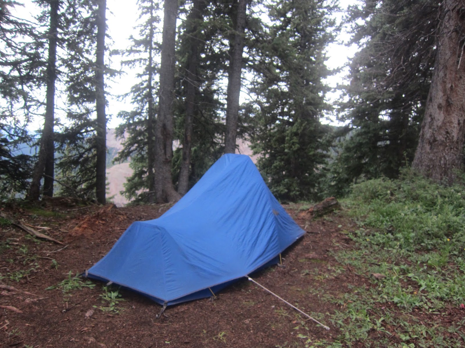
This post takes place on Tuesday, August 1, 2017. It was the third day of a four day backpacking trip on the Colorado Trail from Molas Pass to Durango. I had wanted to get an early start that morning. I had an above treeline stretch that I wanted to get over before the afternoon storms. The night had been dry. As I was packing up my sleeping bag in my tent, I heard some thunder and then sounds of pitter patter on my tent. It only lasted 5 to 10 minutes, but it was enough to make my tent wet. So unfortunately, I had to pack a wet tent. I still got on the trail before sunrise, and it was a beautiful sunrise.
Early light of the day
Sunrise with the Needles on the horizon
Another Sunrise shot
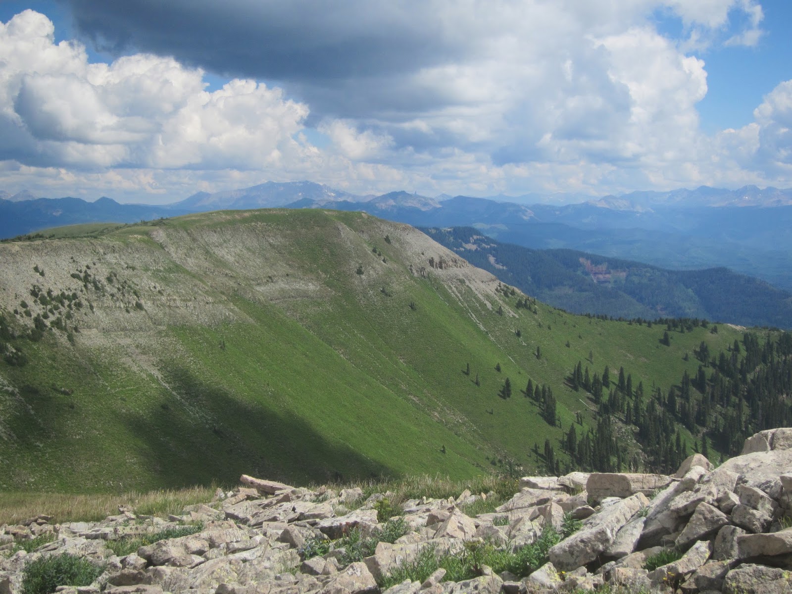
There was a lot of mud on the trail once again. The trail got better as I approached treeline. I was following Indian Trail Ridge up into the La Plata Mountains. The ridge had lots of false summits, but it was beautiful. I was getting worried though. The clouds were building.
Approaching treeline on Indian Trail Ridge
The La Plata Mountains
The Trail
Looking back on the Trail
Another picture of the La Plata Mountains
The trail up another false summit
Looking back on a false summit
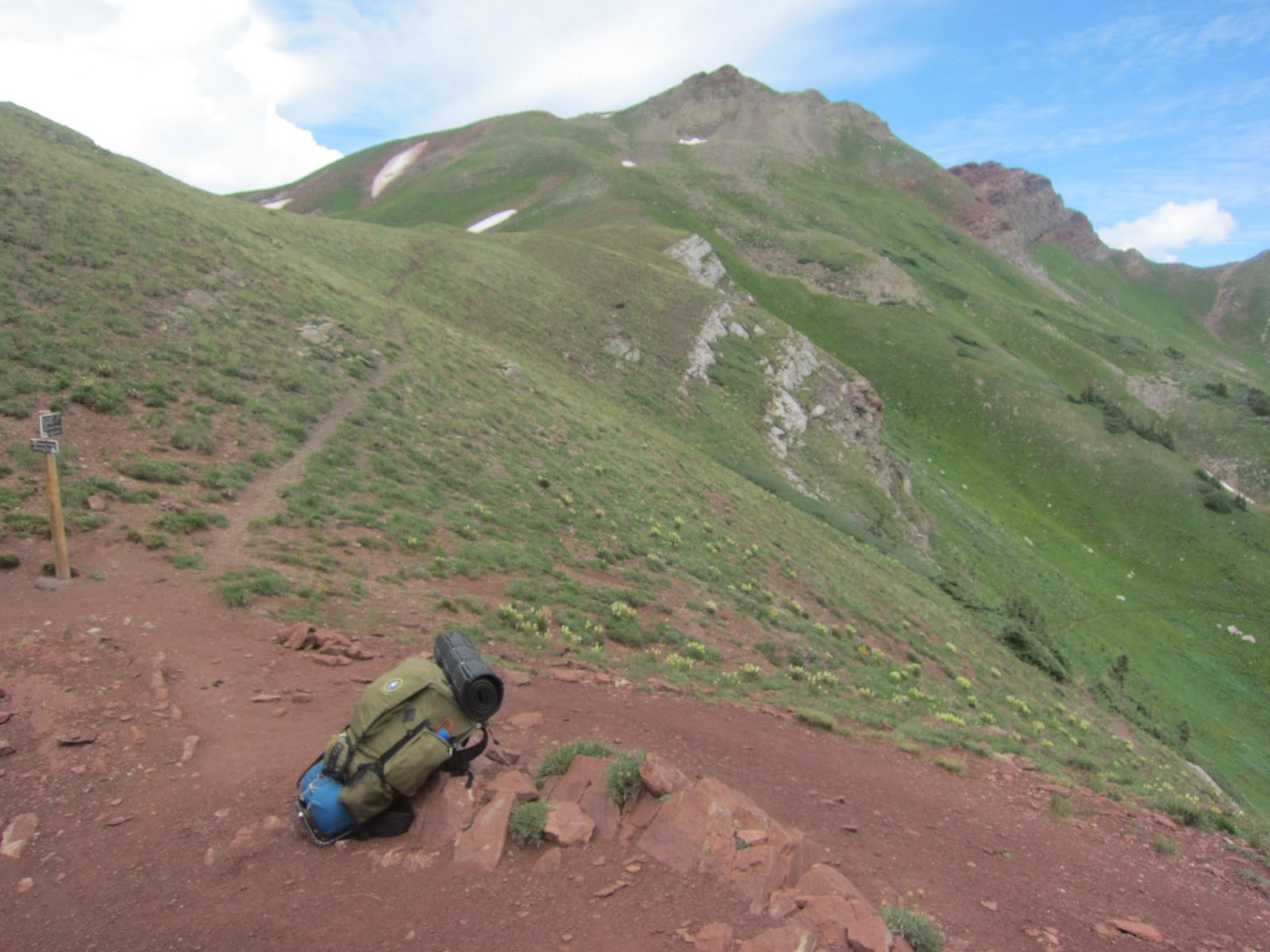
One more summit to climb on Indian Trail Ridge
I reached a high point of 12,310 feet. I wasn’t sure if it was the final high point on the trail until I reached a saddle after the high point and saw the trail head down the mountain. I was going down at the right time. It started raining and hailing about halfway down to Taylor Lake. Fortunately, there was no lightning. The rain was early, as it was only 11:00 A.M.
Looking back from the high point of the trail
View of the La Plata Mountain
Wildflowers after the final uphill climb on Indian Trail Ridge
Snowstorm Peak and Lewis Mountain
View of Kennebec Pass, Cumberland Mountain, Snowstorm Peak, & Taylor Lake
Taylor Lake
The rain had stopped by the time I got down to the Cumberland Basin where Taylor Lake is; however, the trail through the basin was a mud fest, plus the trail was overgrown with water happy plant life. It was not a lot of fun to hike through. As I was leaving the basin, it started to rain and hail again. I found a group of trees in which I was able to take shelter. Once this shower passed, I got moving again. I wanted to get over Kennebec Pass before the next round of rain. I was successful in that achievement. It was good thing too. This next round of rain was harder and included lightning along with more intense hail. I had to take shelter again in some thick trees.
Abandoned mining structures near Kennebec Pass
Looking back at Kennebec Pass and the mining structures
The rest day was mostly downhill with the threat of rain. I dropped down into a canyon which contains Junction Creek. I didn’t like idea of camping in the canyon with all of the rain. Fortunately, the trail didn’t stay in the canyon. Of course, this meant a climb at the end of the day when I was a bit tired. I made it after another 20+ mile day. Naturally, it started raining as I was setting up my tent.
A waterfall in Gaines Gulch
One more post to come…

Friday, August 25, 2017

Who'll Stop The Rain

This post is for the second day of a four day backpack trip on the Colorado Trail from Molas Pass to Durango. The following takes place on July 31, 2017. The rain had stopped by the time I made camp the previous day. So thankfully my tent was dry this morning. Colorado had a wet July. The rain has been more than the usual afternoon showers. The trails were suffering with the extra rain and were extremely muddy. So the trail could be slow going in the muddy places. It was sunny this morning. About a mile into the hike, I crossed a saddle with excellent views of the San Miguel Mountains which is a sub range of the San Juan Mountains. The San Miguel Mountains contains three 14ers: Mt. Wilson, El Diente, and Wilson Peak. It also contains Lizard Head Peak which is considered one of the toughest mountains to climb due to what I call rotten rock. I hiked to the base of it in 2002, but I will never try to climb that one. I don’t do the technical ones, and that one is too dangerous for most of the technical climbers.
Morning view along the trail
After crossing a saddle, I had wonderful view of the San Miguel Mountains and a muddy trail
San Miguel Mountains.  Lizard Head is the point on the far right.
Another view of the San Miguel Mountains
I enjoyed the view of the San Miquel Mountains, but the trail would not take me over there. I was heading south towards Blackhawk Pass (11,985 Ft.) which would be my high point of the day. The climb to the pass was not bad because I started the day above 11,000 feet and never went below 11,000 feet in the 9.5 miles it took to reach the pass that morning. From Blackhawk Pass, I could see rain in the direction I was heading.
Hermosa Peak - the trail would go to the right of it.  There are also deer in this picture.
The deer keeping an eye on me.  Lizard Head in the background
The La Plata Mountains - I didn't know it at time, but I was hiking towards those mountains.
Closer to Hermosa Peak
San Miguel Mountains
Wildflowers on the side of Hermosa Peak
Columbine
The trail to Blackhawk Pass
Blackhawk Pass
Last view of the San Miguel Mountains for the day
Blackhawk Mountain
Rain in the direction I'm heading
On the way down from Blackhawk Pass, I got water from Straight Creek. The data said it was the last reliable on-trail water for 22 miles. So I went full water the rest of the day and did a dry camp that night. The trail that afternoon followed a ridge that was in 10,000 foot range. The hiking was easy except for the muddy spots. It rained on me that afternoon, but it was just a drizzle of a rain so I didn’t get too wet. It was mainly wet boots and socks. I passed up lots of great camp spots because I wanted to make some miles to put me in a better position for the climb I had the next day. I hit a muddy stretch without places to camp late in the day. Fortunately, I found a spot to camp sometime after 6 P.M. The Sun even came out briefly before it set. I tried to dry my socks out, but there was not enough time. I’m guessing I did about 22 miles on this day.
Looking back at Blackhawk Pass
The trail down
Looking back on the ridge I've been hiking after the rain
To be continued…

Wednesday, August 23, 2017

Rainmaker

On Saturday, July 29th, my parents and I drove to Durango. I had been to Durango several times before, but this is the first time I have been there since I had become a Colorado resident in 2006. The town has gotten more spread out, but I still like it. We stayed downtown at the Strater Hotel. It is an old hotel that was built in 1887. It is worth a stay.

The next morning, it was raining in Durango. The plan was to start another backpacking trip. It is never fun to start in the rain. Fortunately, the sky looked brighter to the north where I would start my hike. We drove to Molas Pass where my parents dropped me off. The weather had cleared for the start of my hike.
Potato Hill (Middle) Engineer Mountain (Right)
View along the Colorado Trail
North Twilight Peak (Left) Potato Hill (Right)
Scenery at a saddle along the trail.
Trail entering a wildflower field
A Marmot with Potato Hill in the background
Columbine
A couple of waterfalls
As the day progressed, the clouds started building up again. Fortunately I had gotten past the above treeline portion of that day’s hike before the rain started. It was a long drizzly rain. There was some lightning in the beginning, but the lightning didn’t last long and wasn’t close. I ended up hiking about 18 miles before I found a place in which I wanted to camp.
The picture taker
A small lake near the intersection of the Engineer Mountain Trail
Rolling Mountain
Looking back on the trail
Heading towards the pass that is south of Rolling Mountain
Northern view of Twin Sister East & West from the pass
Looking south from the Pass (12,500 ft)
Fields of wildflowers on the way down from the pass
Looking back at the pass
Paintbrush
Sheep
Camp
More Colorado Trail posts to come…