I got back to some serious hiking on Saturday. I’m climbed Mt. Yale which has an elevation of 14,202 feet. They say you can see thirty 14ers up there. I didn’t pick out that many, but I did see quite a few. I did the standard route up from the Denny Creek Trailhead. The trailhead is easy to get to. It is right on the Cottonwood Pass Road. So it was a paved road all the way to the trailhead. I stayed in Buena Vista the night before. So I had real short drive to the trailhead in the morning and was able to get an early start without being tired out from a long drive. The trail was short. It is only a seven mile round trip. The trailhead is at 9,900 feet. So there is 4,300 foot vertical gain. The trail is in great shape. It is not too hard. It is mainly a steady walk up. There is a little of Class 2 climbing near the top. That is where you may need to use your hands for balance. Anyway, I made it to the top without stopping for any water breaks. I didn’t even stop to take my camera out till I got to the top. So here are the pictures starting from the top.
Mt. Princeton is on the left. Antero, Shavano, & Tabeguache are in the center of the picture
Right to Left: Columbia, Harvard, Oxford, & Bedford.
Buena Vista and Pikes Peak
Me with a bunch of 14ers behind me
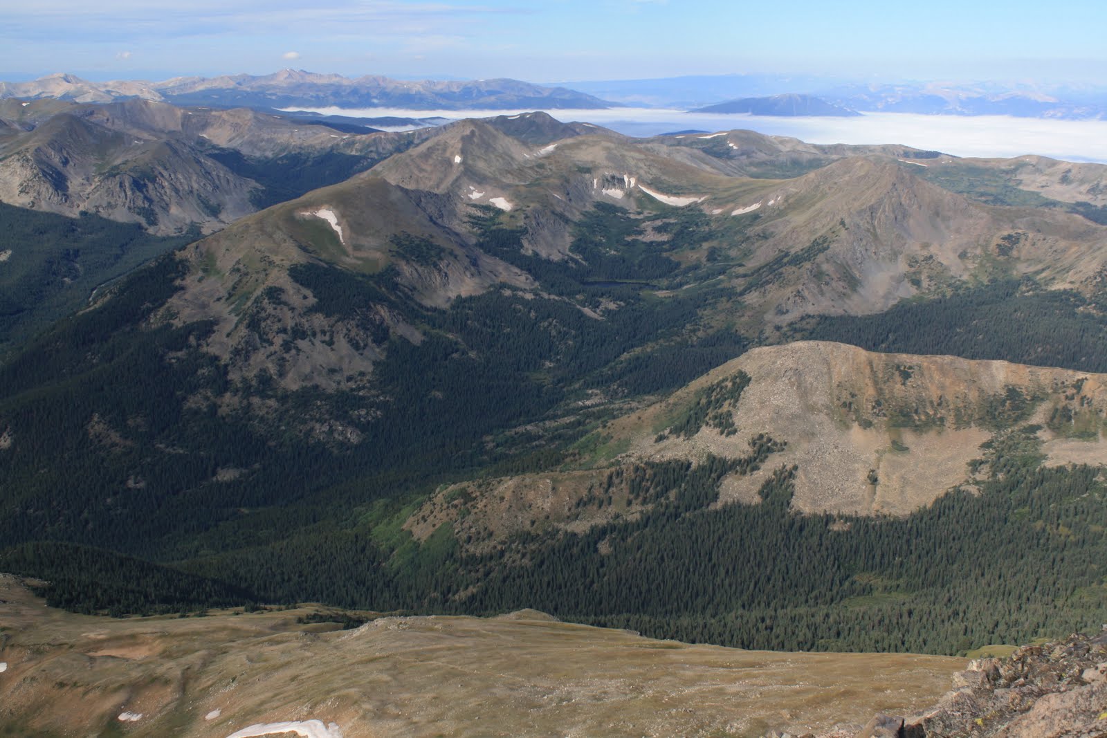
Looking west towards the cloud covered Taylor Park Reservoi
The start of the trail down.
Me with Beford, Oxford, Harvard & Columbia behind me.
Here is a find Mike in the crowd photo. We haven't had one of those in a while.
The Rapids were home last weekend, so I didn’t do any serious hiking. However, I did go for a short a hike before the game. I hiked to Lizard Rock in the Tarryall Mountains. The trail is located of County Road 77 between Lake George and Jefferson. Here are a few pictures from Lizard Rock.
I went for another hike last Saturday in the Sangre de Cristo Mountains. I climbed Cottonwood Peak (13,588 ft.) I used the Garner Creek & Hot Spring Canyon Trailhead located in the northern half of the San Luis Valley. The trailhead is below 9,000 feet so it was a good haul. I took the Hot Springs Canyon Trail up. It was a long steady climb. Above treeline, there were lots of pikas keeping me company. The views were great. It was a bit hazy, but I managed to filter out some of the haze in my pictures. There was a register at the top. I was the first person to sign it in a month. After enjoying the view, I worked my way down to opposite side of the peak in order to make this hike a loop trail. The going was rough at first due to lots of loose rocks, but I made it over to the established trail. I followed the Garner Creek Trail back to my car. It was full day of hiking, and I didn’t see a soul. I was the only one to sign the register at the trailhead for that day. I know that this isn’t the Front Range, but I still would have thought others would have hiked at least part of one of these trails on a Saturday. Oh well, I definitely not complaining!
Cottonwood Peak in sight after a false summit
Looking back
Pikes Peak on the horizon
Looking at the northern end of the San Luis Valley
Me on top Cottonwood Peak
Crestone Group on the horizon
Silver Lake
Flowers
Looking back at Cottonwood Peak and lots of rocks
The Garner Creek Trail goes thru the canyon all the way to the valley
I saw a beautiful goal Friday evening. Brian Mullan hit a screamer in the Rapids 2-0 victory over the Crew. I hang out in the supporter’s section. The view is not great down there, but I saw this goal all the way. From where I was at, it looked liked the ball was heading right for me. Thankful, the net caught it. Here is a YouTube video of the goal, unfortunately it is not the view I had.
On Sunday, I climbed Carbonate Mountain (12,250 ft) in the Sangre de Cristo Mountains. To start the hike, I drove to Mosca Pass. There is a road up to pass on the eastern side. It is one of the few gravel roads in the Sangre de Cristo Mountains that I can drive with my car. The trail to Carbonate Mountain is not well known. There are no signs pointing the way. To get to the trail, I followed the Mosca Pass Trail east for about 300 yards. Then I took an unmarked trail that went off to the left. Shortly after getting off the Mosca Pass Trail, I came across the ruins of an old cabin in a beautiful meadow.
Afternoon shot of the cabin in the meadow
From the cabin, I followed a path that took me to the ridgeline. For the most part, the path follows the ridgeline the rest of the way up. The first grand view came at an unnamed knob at 11,268 feet. I could basically see the entire sand field of the Great Sand Dunes National Park.
The Great Sand Dunes
Mosca Pass
The false summit of Carbonate Mtn on the right. Mt. Lindsey peaking out on the left.
The path was not as obvious after the view from the knob. I guess the few people that find this trail are satisfied with that view. My goal was to go further though. After a steep climb, I reached treeline. And to my surprise, I found an abandoned miners cabin on top of the ridge. There was an abandoned mine shaft that was nearby as well. The cabin had a pretty good view to say the least.
Miners Cabin. Picture taken from the ridgeline.
From the cabin, I climbed the false summit. The top of the Carbonate Mountain is just beyond the false summit.
View of Carbonate Mtn from the false summit.
View of Mt. Lindsey, Iron Nipple, Blanca Peak, and others.
From the top of Carbonate Mountain, I was looking at the map and noticed that the next major peak over was a little bit higher than Carbonate Mountain. There was also something on the top of the peak. (I’m not sure if the peak has a name. Google Earth marks it as North Zapata Ridge. It is the high point of that ridge at 12,330 ft.) I figured it was less than a mile to the peak. The weather was perfect. So I kept going and expanded my goal.
Blanca Peak in the center. North Zapata Ridge with object on top on the right.
The object on top of the peak turned out to be a major rock cairn. There were some nice wildflowers on top of the peak. There were also some white rocks which I am guessing is marble, but I’m not a geologist. Anyway, I turned around and made the trek back to my car from there. It was a beautiful and interesting hike.
Rock Cairn on top of North Zapata Ridge
A Flower
A view of the Dunes with Kit Carson Mtn. and Crestone Peaks visible on the right.
White rocks, Carbonate Mtn, & Mt. Herard.
The Dunes. Day Use area and CG is visible if you know where to look.
I’m a little late posting this hike. It is a blog worthy hike, so here it is. Last Saturday, I hiked to the Horn Lakes. The Lakes are in the Sangre De Cristo Mountains. I used Horn Creek Trailhead once again. It is the third time that I have used that trailhead. There are lots of good trails out of it. The hike was 11 miles round trip. It was an easy hike. The climb is pretty gradual which I can’t say about the other two hikes that I’ve done in the area. Anyway, here are the pictures.