
Sunday, December 18, 2011
11
Turn it up to 11, it is Carter’s Birthday! My buddy Chuck was out here again. I had hoped that he would help celebrate Carter’s Birthday again, but he said “why bother, Carter won’t believe that I went to Colorado for his birthday.” We sort of celebrated anyway. Landon couldn’t come this year. He is busy getting ready for his Everton loan in England. I didn’t want him to show up anyway, he would probably gloat too much about the Galaxy’s championship. Have Happy Birthday Carter; I hope it is a great one!

Sunday, December 11, 2011
The Horse Thief
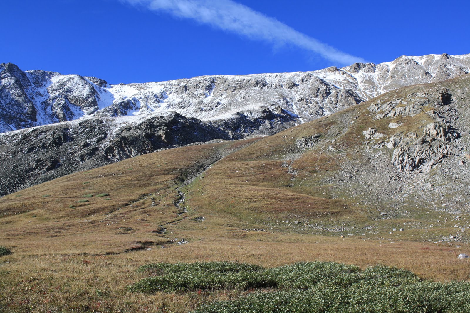
I went for a hike on Sunday. I went to Horsethief Falls and Horsethief Park. The trailhead for the hike is the same trailhead that I used for the Pancake Rocks hike I did over a year ago. It is north of Cripple Creek and west of Pikes Peak. The weather was nice, but it was still quite cold in the shade. The waterfall was frozen over, but I could hear the water under the ice. After viewing the falls, I hiked north through Horsethief Park. Here are some pictures.
 |
| Horsethief Falls |
 |
| Looking down the Falls |
 |
| The creek |
 |
| Horsethief Park |
 |
| Sentinel Point |
 |
| The trail |
 |
| A beaver dam at the northern end of Horsethief Park. |
Thursday, November 24, 2011
Climb That Hill
I got out and went hiking on Thanksgiving; however, I didn’t climb a mountain. I climbed a hill instead. The hill is called Midland Hill (9,556 ft.) The trailhead for it is at Riverside Park in Buena Vista. The hike is about a five mile round trip. The views were great. The weather was quite nice. It was warmer than I expected. I wish I had worn shorts. There were quite a few people out for a Thanksgiving Day. I did time the summit right. I had it to myself. I hope everyone had a great Thanksgiving.
 |
| Mt. Princeton |
 |
| Mt. Columbia |
 |
| Me on Midland Hill |
 |
Looking south from the top of Midland Hill |
 |
| Mt. Yale and Buena Vista |
 |
| Mt. Yale, Mt. Columbia, and the top of Midland Hill |
 |
| The trail below the summit on the north side. |
Monday, October 24, 2011
Blue Cyclone
This past weekend my friends Charles and Tina along with Tina’s cousin Kevin were in Colorado. I met up with them at their campsite at Great Sand Dunes National Park. We hung out and went for a short hike on Saturday. We hiked to Zapata Falls and a little ways beyond.

Charles & Kevin working their way to Zapata Falls. The falls is around the corner.

Zapata Falls

Me at my cabin

Looking out the cabin door.

Kevin, Tina, & Charles hiking

Lonely Yellow Trees

Charles, Yellow Trees, Sand, & Mountains

Fall Color near Zapata Falls

Fall Color and the San Luis Valley.
After the hike, we went back to their campsite and did some beer tasting. There were some very good beers. Tommyknockers Vienna Amber was my favorite.

The beautiful beer tasting venue.

The Beers (Sunshine & 1554 hidden by salsa)
You might wonder why the Blue Cyclone as a title. Beer drinking and blue ice chest triggered the memory of the song with Charles. Kevin was able to find the song on YouTube through his phone. So we got to listen to it. I didn’t realize there were two parts to the song. Anyway, below is the Ballad of the Blue Cyclone Parts 1 and 2 if you care to revisit this infamous song from the past.
Monday, September 19, 2011
Show Me
Another weekend, another 14er. I climbed Missouri Mountain on Sunday. At 14,073 feet, Missouri Mountain is shortest of the 14ers I did this season, but it may be my favorite of the five. I used the Missouri Gulch Trailhead which is the same trailhead I used the previous weekend for my hike up Mt. Belford and Mt. Oxford. The hike is 10 miles round trip. I started at daybreak. It was a bit on the cold side. The mountains had a touch of snow on them at the higher elevations. There was dramatic drop in the number of people hiking this weekend. I saw only four other people climbing Missouri Mountain. I had the summit to myself. The wind was a bit brutal up top, but I found a spot out of the wind on southwest side where I was able sit and enjoy the view. On the way down, I warmed up enough to strip down to shorts and a short sleeve shirt. This is probably it for my tour of 14ers in Sawatch Range this season. I'll be busy with the Rapids back in town the next couple of weekends. It won’t be long for it to be too cold for my tastes at the higher elevations. Anyway, enjoy the photos.
 |
| The climb up this ridge is where the trail gets a little tough. |
 |
| Looking back on the easy part of the trail. |
 |
| Looking back from the top of the ridge. Mt. Belford (Left) Mt. Harvard (right) |
 |
| Huron Peak |
 |
| The trail on the ridge |
 |
| The top of Missouri Mountain is in sight. |
 |
| View from the top. The Three Apostles are in the clouds. |
 |
| Huron Peak |
 |
| Mt. Princeton, Mt. Yale, Mt. Antero, Mt. Shavano, & Tabeguache Peak |
 |
| Harvard and Columbia on the left. |
 |
| The ridge of Missouri Mtn. La Plata Peak (center) Mt. Elbert (right) |
 |
| Missouri Gulch. The shoulder of Mt. Belford is on the right. |
 |
| Mt. Belford is on the left. Mt. Oxford is peaking out in the middle. |
 |
| Me |
 |
| Mt. Belford from Missouri Gulch. |
Sunday, September 11, 2011
The Rising
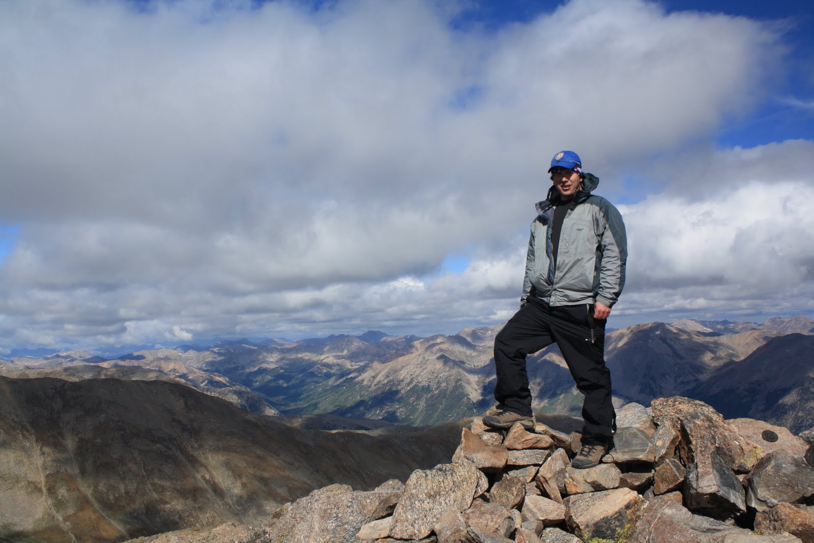
Today, I climbed my 10th and 11th 14er. I did Mt. Belford (14,205 ft.) & Mt. Oxford (14,160 ft.) The mountains are located in the Collegiate Peaks Wilderness northwest of Buena Vista. I took the standard route from the Missouri Gulch trailhead (9,640 ft.) Mt. Belford was the first and last of the 14ers I climbed on the day. It was 3 and half mile hike to the top of Mt. Belford from the trailhead. It was quite cold on top of Mt. Belford. I didn’t stay too long due to the wind and because I needed to keep moving so that I could climb Mt. Oxford.
From the top of Mt. Belford, I hiked down to a saddle of about 13,500 feet. I then started up Mt. Oxford. Trail distance between Mt. Belford and Mt. Oxford is about 2 miles. The climb up Mt. Oxford from the saddle was relatively easy. By the time I got to the top, the Sun was partially out, and the wind did not seem as bad.
To get back to my car I had to backtrack back over Mt. Belford. The climb up Mt. Belford from the saddle is quite steep. I would say it was toughest part of the hike. I made it, and I was rewarded with some nicer temperatures on top Mt. Belford. I could also see a little bit more. There were surprisingly a lot of clouds in the area this morning. The clouds never threaten, but I kept an eye on them. I made it back to my car around 2 pm. It was a tough day, but obviously it was worth it.
 |
| Mt. Oxford from the top of Mt Belford. |
 |
| Top of Missouri Mtn. on the right. Huron Peak is right center behind the ridge. |
 |
| Me on Mt. Belford |
 |
Me on top of Mt. Oxford |
 |
Looking back on Mt. Belford. |
 |
| Mt. Harvard. To the right of Mt. Harvard is Mt. Yale with its top in the clouds. |
 |
| Look,there is a pika on that rock. |
 |
Me on Mt. Belford again |
 |
| The way down |
 |
| Mt Oxford on the left and the summit of Mt. Belford on the right. |
 |
| LaPlata Peak on the left. Mt. Elbert is right center. |
 |
| An alpine flower. |
Subscribe to:
Posts (Atom)
