Friday, December 22, 2017

Down By The River

The hike in this post took place on Sunday, November 26, 2017. I went to Browns Canyon National Monument for this stroll. I started my hike at the Ruby Mountain Trailhead. It is near Nathrop which is near Buena Vista. I didn’t get on the trail till 10 A.M. for this hike. The weather was nice. I was in shorts by the end of my hike. I even saw someone out sunbathing on my way home. If I remember right, my hike lasted around four hours. I hiked down to the Arkansas River on the second trail that went down to the river. I followed a fishermen trail that connected back to the first river access trail. It saved me some time otherwise I would have had a long backtrack. A good portion of the trails here follow dry stream beds. Anyway here are the pictures.
Mt. Princeton & Mt. Yale from Ruby Mtn. Trailhead
Mt. Yale & Mt. Columbia
Mt. Antero, Mt. Princeton, & Nathrop
Arkansas River & Mt. Ouray
Mt. Yale and Nathrop
Mt. Princeton while on the River Access Trail (6045B)
River Access Trail (6045B)  It is the dry stream bed.
Mt. Princeton, Mt. Yale, Mt. Columbia, & the Arkansas River
Mt. Antero and the Arkansas River
Mt. Princeton & the Arkansas River
Arkansas River
River Access Trail (6045A)
Turret Trail (6045) Buffalo Peaks
Buffalo Peaks

Saturday, November 25, 2017

Castles Made of Sand

The weather was beautiful in Colorado on Thanksgiving. So I decided to make the long drive to the Great Sand Dunes National Park and Preserve where I did my Thanksgiving hike on the dunes. There were quite a few other people at the Dunes as well. I was able to avoid most of the people by taking a more challenging route up the sand dunes. I climbed High Dune first. Although there were plenty of footprints on top, I had the top of High Dune to myself.
San Juan Mountains in the distance
Approaching High Dune.  Mt Herard on the left
Me on top High Dune
Me looking at Star Dune from High Dune
From the top of High Dune, I could see a couple of people on top of Star Dune. I had hiked to the top of Star Dune once before, but I had not done High Dune and Star Dune in the same day before. The weather was nice. It was not too windy, cold, or hot. I also felt good, and I had plenty of time. So I decided to head in that direction and see what happens. After an enjoyable hike across the dunes, I made it to the top of Star Dune and had lunch.
Looking back at High Dune from the top of Star Dune
Looking south from the top of Star Dune
Looking west across the San Luis Valley
Me on top of Star Dune
Another shot of me on top of Star Dune
After lunch, I worked my way off the dunes by heading towards Medano Creek. The creek bed was dry when I got to it. I followed the creek bed upstream towards the day use area where I was parked. I came across a herd of elk. I watched the bull shepherd the herd around me. It was beautiful site.
Looking back at Star Dune with some 14ers barely visible
A herd of elk in the creek bed for Medano Creek
The elk being shepherded around me
Elk and Mt. Herard
Elk and the Dunes
The elk working their way back to the creek bed
Elk Tracks
After watching the elk, I found the current place where Medano Creek disappears into the sand. After another mile of hiking, I made it back to my car. I was a bit tired from the walking in the sand for four plus hours, but it was a good hike.
The flow terminus for Medano Creek
Medano Creek, Mt. Herard, and the Dunes

Tuesday, September 26, 2017

Lakes

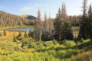
On September 9th, I did the Lake of the Clouds hike in the Sangre de Cristo Mountains. I associate Lake of the Clouds with the namesake in New Hampshire. This Lake of the Clouds is actually three lakes. They are located due west of Westcliffe and accessed via the Gibson Creek Trailhead. The hike is around 10 miles for a round trip. Here are the pictures.
The Lower Lake
Wildflowers along the trail between the 1st and 2nd lake
The Middle Lake
Marsh and stream between 2nd and 3rd lake (From the Upper Lake)
Marmot on a rock
Upper Lake
View below the Upper Lake
Looking across the marsh towards the Upper Lake
Middle Lake
Waterfall along Swift Creek

Monday, September 18, 2017

If You Believe In Cleveland

The hike for this post happened on August 26, 2017. I did a hike that took me above Browns Pass in the Collegiate Peaks Wilderness. I started at Denny Creek Trailhead on Cottonwood Pass Road. The trailhead was packed with cars because it is also the trailhead for Mt. Yale. Most people were doing that hike. I followed the Browns Pass Trail to Browns Pass on the Continental Divide. Browns Pass is just above treeline. It had some nice views, but I still felt like going. So I took the Kroenke Lake Trail east up a ridge that took me to a higher point on the Divide.
Browns Pass
At Browns Pass
Looking back on the Browns Pass Trail
The trail up to a saddle on the Continental Divide.  View of Mt. Harvard
At a saddle on the Continental Divide
The Three Apostles (up high) and Texas Creek (below)
At a saddle on the Continental Divide, the trail drops down to Kroenke Lake on the Atlantic side of the divide. I did not go to the lake. I took in the views of the mountains that surrounded me. I decided to climb a little higher. There was an unnamed peak to the south. I decided to climb that to get an even better view. I was not disappointed. The view was great. I picked out several 14ers. I stayed on top for a while. I had it to myself. It was a fun little hike.
Unnamed Peak that I decided to climb
Mt. Yale
Approaching the top of the Unnamed Peak
Looking down on Browns Pass
Hartenstein Lake, Turner Peak, and the route I took is below
Mt. Harvard, Mt Columbia, & Kroenke Lake
Mt. Harvard & Mt. Columbia
The Three Apostles and Huron Peak
Mt. Yale and Mt. Princeton
Mt. Princeton, Mt Antero, Mt. Shavano, & Tabeguache Peak
Mt. Columbia, Kroenke Lake, an unnamed pond.
Me. Mt. Harvard and Mt. Columbia
Missouri Mountain, Mt. Belford, Mt. Oxford, Mt. Harvard, & Mt. Columbia